
Related on my post about RF Site Survey Steps that i took from wifi-planet Jim Geier May 10, 2002.
i like to continue about site survey in wireless network.
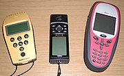
usualy most wireless enginer user GPS (Global Positioning System) for site survey) this story about GPS that i took from wiki.
The Global Positioning System (GPS) is the only fully functional Global Navigation Satellite System (GNSS). Utilizing a constellation of at least 24 Medium Earth Orbit satellites that transmit precise microwave signals, the system enables a GPS receiver to determine its location, speed, direction, and time. Other similar systems are the Russian GLONASS (incomplete as of 2007), the upcoming European Galileo positioning system, the proposed COMPASS navigation system of China, and IRNSS of India.
Developed by the United States Department of Defense, GPS is officially named NAVSTAR GPS (Contrary to popular belief, NAVSTAR is not an acronym, but simply a name given by Mr. John Walsh, a key decision maker when it came to the budget for the GPS program).The satellite constellation is managed by the United States Air Force 50th Space Wing. The cost of maintaining the system is approximately US$750 million per year,[ including the replacement of ageing satellites, and research and development.
Following the shootdown of Korean Air Lines Flight 007 in 1983, President Ronald Reagan issued a directive making the system available for free for civilian use as a common good.[3] Since then, GPS has become a widely used aid to navigation worldwide, and a useful tool for map-making, land surveying, commerce, and scientific uses. GPS also provides a precise time reference used in many applications including scientific study of earthquakes, and synchronization of telecommunications networks.
Simplified method of operation
A typical GPS receiver calculates its position using the signals from four or more GPS satellites. Four satellites are needed since the process needs a very accurate local time, more accurate than any normal clock can provide, so the receiver internally solves for time as well as position. In other words, the receiver uses four measurements to solve for 4 variables - x, y, z, and t. These values are then turned into more user-friendly forms, such as latitude/longitude or location on a map, then displayed to the user.
Each GPS satellite has an atomic clock, and continually transmits messages containing the current time at the start of the message, parameters to calculate the location of the satellite (the ephemeris), and the general system health (the almanac). The signals travel at a known speed - the speed of light through outer space, and slightly slower through the atmosphere. The receiver uses the arrival time to compute the distance to each satellite, from which it determines the position of the receiver using geometry and trigonometry
Although four satellites are required for normal operation, fewer may be needed in some special cases. For example, if one variable is already known (for example, a sea-going ship knows its altitude is 0), a receiver can determine its position using only three satellites. Also, in practice, receivers use additional clues (doppler shift of satellite signals, last known position, dead reckoning, inertial navigation, and so on) to give degraded answers when fewer than four satellites are visible.
ok reader i will contiinue next post, still about wireless lan and site survey
Saturday, January 19, 2008
Global Positioning System for Wireless site survey
Subscribe to:
Post Comments (Atom)


No comments:
Post a Comment